 KFLSEBAS1 - CW7841 in Sebastian, Florida KFLSEBAS1 - CW7841 in Sebastian, Florida  Real Time Weather Statistics from Sebastian Highlands |
|
 |  |  | 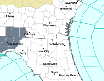 | 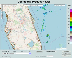 |  | 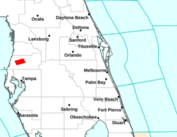 |
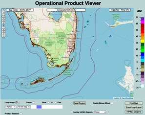
| National Doppler Radar Sites | Jacksonville Florida Multi-Radar, Multi-Sensor (MRMS) Radar | Jacksonville Florida Short Range Radar | NWS Forecast Office Jacksonville, Florida | Melbourne Florida Multi-Radar, Multi-Sensor (MRMS) Radar | Melbourne Florida Short Range Radar | NWS Forecast Office Melbourne, Florida |
 |  |  | 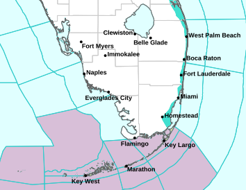 | 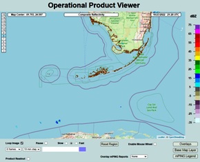 |  |  |
| Southeast Sector Mosaic Radar Radar | Miami Florida Multi-Radar, Multi-Sensor (MRMS) Radar | Miami Florida Short Range Radar | NWS Forecast Office Miami-South Florida | Key West Florida Multi-Radar, Multi-Sensor (MRMS) Radar | Key West Florida Short Range Radar | NWS Forecast Office Key West Florida |
 | 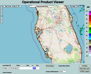 |  | 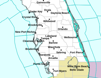 | 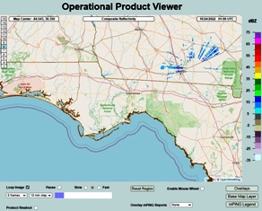 |  | 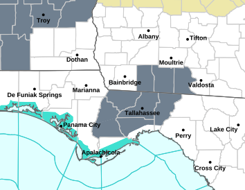 |
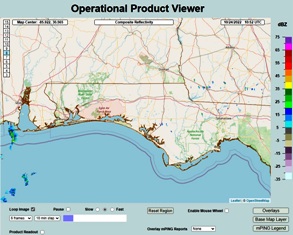
| Southern Mississippi Valley Sector Mosaic Radar | Tampa Bay Florida Multi-Radar, Multi-Sensor (MRMS) Radar | Tampa Bay Florida Short Range Radar | NWS Forecast Office Tampa Bay Florida | Tallahassee Florida Multi-Radar, Multi-Sensor (MRMS) Radar | Tallahassee Florida Short Range Radar | NWS Forecast Office Tallahassee Florida |
 |  |  |  |  |  |  |
| Northeast Sector Mosaic Radar Radar | Northwest Florida Multi-Radar, Multi-Sensor (MRMS) Radar | Northwest Florida Florida Short Range Radar | NWS Forecast Office Mobile & Pensacola | San Juan, Puerto Rico Multi-Radar, Multi-Sensor (MRMS) Radar | San Juan, Puerto Rico Short Range Radar | NWS Forecast Office San Juan Puerto Rico |
 |  |  |  |  |  |  |
| Aviation Weather Central CONUS Radar Imagery | Aviation Weather Central Austin, TX Radar Imagery | Aviation Weather Central Montgovery, AL Radar Imagery | Aviation Weather Central Tampa, FL Radar Imagery | Aviation Weather Central Charlotte, NC Radar Imagery | Aviation Weather Central Baltimore, MD Radar Imagery | Aviation Weather Central Albany, NY Radar Imagery |
 |  |  |  |  |  |  |
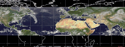
| GOES-East CONUS View GeoColor Image | GOES-East Northeast U.S. GeoColor Image | GOES-East U.S. Atlantic Coast GeoColor Image | GOES-East Southeast U.S. GeoColor Image | GOES-East Gulf of Mexico GeoColor Image | GOES-East Tropical Atlantic Wide View GeoColor Image | GOES-East Caribbean Sea GeoColor Image |
 |  |  |  |  |  |  |
| GOES-East CONUS View GeoColor Image | METEO SAT Northeast Atlantic AVN Color Image | METEO SAT Eastern Atlantic AVN Color Image | GOES-East Eastern Pacific GeoColor Image | GOES-West Tropical Pacific Sector View GeoColor Image | GOES-West PACUS View GeoColor Image | GOES-West Northern Pacific GeoColor Image |
 |  |  |  |  |  |  |
| GOES-East CONUS View Band 13 - 10.3 �m Clean Longwave Window - IR | GOES-East Northeast U.S. Band 13 - 10.3 �m Clean Longwave Window - IR | GOES-East U.S. Atlantic Coast Band 13 - 10.3 �m Clean Longwave Window - IR | GOES-East Southeast U.S. Band 13 - 10.3 �m Clean Longwave Window - IR | GOES-East Gulf of Mexico Band 13 - 10.3 �m Clean Longwave Window - IR | GOES-East Tropical Atlantic Wide View Band 13 - 10.3 �m Clean Longwave Window - IR | GOES-East Caribbean Sea Band 13 - 10.3 �m Clean Longwave Window - IR |
 |  |  |  |  | 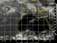 |  |
| Infrared NHC Enhancement - North Atlantic GOES-East CIMSS TC Webpage | Infrared NHC Enhancement East Atlantic MSG | Infrared Color Background North Atlantic GOES East | Infrared Color Background East Atlantic MSG | Infrared North Atlantic GOES-East | Infrared East Atlantic MSG | Infrared Mosaic Color Background Atlantic Region GOES East MSG - HIMAWARI |
 |  |  | |  |  |  |
| GOES-West Full Disk GeoColor Image | GOES-East Mexico GeoColor Image | HIMAWARI-8 West Central Pacific IR Image | HIMAWARI-8 Tropical West Pacific IR Image | HIMAWARI-8 Tropical West Pacific Wide View IR Image | GOES-West Hawaii GeoColor Image | GOES-West West Coast GeoColor Image |
_Cropped_Final.jpg) |  |  |
| Ambient Weather and Weather Underground Never base important decisions on this or any weather information obtained from the Internet Portions of this Web Page are updated automatically by Virtual Weather Station V15.00 p03 Please note that some of the functionality of this WEB site depends upon outside sources like KFLSEBAS1 Home KFLSEBAS1 Super Compass (Beta) KFLSEBAS1 Graphs and Gauges KFLSEBAS1 Daily Report KFLSEBAS1 Weather Details Forecast Weather-USA-Area-Zone-Coastal-Surf NWS Radar and Forecast Offices Hazardous Weather Outlook Graphical Weather Links Weather WEB Sites Tropical Weather Page Hurricane Hunters Daytona, Florida 2007 Hurricane Wilma Video Archived Hurricane Radar Images Archived Hurricane Satellite Images Steel Series Weather Gauges User Selection Steel Series Weather Gauges Laura's Sebastian, Florida Lynda's Sebastian, Florida Rick's Sebastian, Florida Conversion Calculator Local Vendors Pick List Disclaimers Site Map One Stop * This page was last updated on Friday, August 15, 2025 06:18:40 PM Copyright© 2001 to Infinity and Beyond: KFLSEBAS1 WEB Site designed and maintained by TVOR 😉 That'll do pig. That'll do.  |